37 Million California Residents on Flood Watch amid Back-to-Back Storms
TEHRAN (Tasnim) – An already drenched California is bracing for a second storm as a multiday atmospheric river is projected to bring rainfall, wind and snowfall to the Golden state Sunday and extend through Wednesday.
The National Weather Service issued a flood watch for nearly the entire coast of California -- from Redding to San Diego and the Mexico border -- putting about 37 million residents on alert.
The first storm hit central California on Saturday, dumping less than half an inch of rain at lower elevations and around an inch at higher elevations.
The next storm starts Sunday afternoon, bringing stronger rainfall, wind and snowfall across the state.
The flood watch includes Northern California cities such as San Francisco, Monterey, Chico and Fresno; Central California cities including Santa Barbara, Los Angeles and Temecula; and San Diego in Southern California.
Total rainfall throughout the flood watch area includes two to five inches in the lower elevations and up to eight inches in the higher elevations.
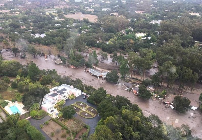
Santa Barbara County has the highest threat of flash flooding, mudslides and rockslides, according to officials.
"Be prepared to sustain yourself and your household for multiple days if you choose not to evacuate, as you may not be able to leave the area and emergency responders may not be able to access your property in the event of road damage, flooding or debris," Santa Barabara County officials said in a press release Saturday.
The coastal city is still recovering from the barrage of rain that hit the region less than two weeks ago.
Wind alerts are in effect for millions of California residents, including those in San Francisco and Santa Barbara, with wind gusts projected to be between 50 mph and 60 mph.
The strongest winds will be felt Sunday and Monday morning.
A few feet of snow is possible in the San Gabriel Mountains outside Los Angeles, with areas including Big Bear Lake seeing up to 8 inches of snow.
Gusty winds will also make travel difficult in these snow areas.
Back-to-back atmospheric river storms have soaked California this month. Atmospheric rivers are essentially rivers in the sky that collect moisture from tropical areas and redistribute the water to higher latitudes, according to the National Oceanic and Atmospheric Administration (NOAA).
"More of (California's) precipitation, so rain and snowfall, will be coming from atmospheric rivers, according to the model projections," Julie Kalansky, a climate scientist and deputy director of operations at the Center for Western Weather and Water Extremes at the University of California, San Diego's Scripps Institution of Oceanography, told ABC News earlier this month.
Experts say that this shift in precipitation type could be accompanied by more frequent and intense extreme rainfall events.


